BUILD YOUR OWN
RESOURCE LIBRARY
Special Reports
SusHi Tech Tokyo 2024: experience ‘Tokyo 2050’ todaySponsored by The SusHi Tech Tokyo 2024 Showcase Program Executive Committee
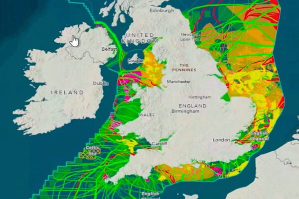
Crown Estate uses Esri GIS to develop plans for UK seabed

The Whole of Seabed approach uses Esri’s GIS software to create scenarios which simultaneously consider the demands upon the seabed up to 2050
Oh no, sadly you have viewed the maximum number of articles before we ask you to complete some basic details. Don't worry, it's free to register and won't take you longer than 60 seconds!
Latest City Profile
SmartCitiesWorld Newsletters (Daily/Weekly)
BECOME A MEMBER


