BUILD YOUR OWN
RESOURCE LIBRARY
Special Reports
SusHi Tech Tokyo 2024: experience ‘Tokyo 2050’ todaySponsored by The SusHi Tech Tokyo 2024 Showcase Program Executive Committee
Levelling the data playing field for coastal communities

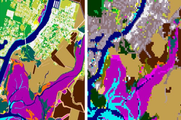
The image on the right shows 30-metre land cover data for Shelter Bay in Skagit County, Washington, while the image on the left shows the same area with 1-metre high-resolution land cover data, making the product 900 times more detailed. Image: NOAA Office for Coastal Management
Oh no, sadly you have viewed the maximum number of articles before we ask you to complete some basic details. Don't worry, it's free to register and won't take you longer than 60 seconds!
Latest City Profile
Latest Trend Report
SmartCitiesWorld Newsletters (Daily/Weekly)
BECOME A MEMBER


